Urban geographies of artificial intelligence
Re-mapping the city in a machine-readable world (postdoctoral project)
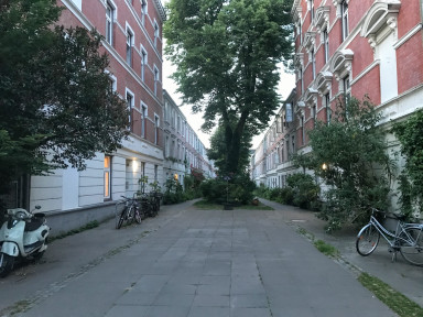
This research is situated at the interface of urban political economy and digital technology. Against the grain of a widespread infatuation with ‘smart’ technologies and corporate ‘disruptions’, it is one of the main tenets of my research that existing urban space, in its full physical and social complexity, unevenness, and messiness, has a crucial role to play within the ongoing digital transformation of our cities. I continue to be particularly interested, therefore, in those neuralgic points of contact where the abstract logics of tech business models by companies such as Amazon, Google or Uber ‘hit the ground’ of existing urban space in socio-spatial arenas such as local state regulation or regional infrastructure politics. Combining critical urban theory with in-depth ethnography, my research aims to show that the ‘smartification’ of the urban does not take place in a material and social void; rather, the gradual consolidation of the so-called ‘smart city’ represents a politically highly charged process unfolding in, with, and against the dense thickness of existing urban space.
- platformization
- smart cities
- urban political economy
- artificial intelligence
- HD mapping
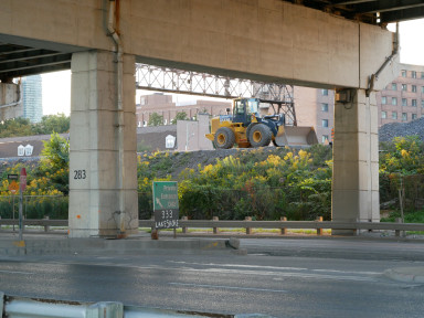
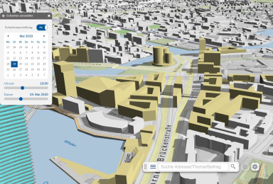
In my current research project ‘Urban Geographies of Artificial Intelligence’, I examine the urban integration of AI applications with a focus on urban data extraction and production. In particular, I am interested in socio-technological processes of HD mapping in which entire cityscapes are digitally captured and remodelled in three-dimensional virtual space, creating the operative ground as well as necessary training data for AI-based forms of urban automation such as self-driving cars, drones or delivery robots.
Methodologically, I approach the phenomenon of HD mapping from two complementary angles: on the one hand, I harness critical research in and beyond the realms of critical urban theory, media studies, and science and technology studies in order to bring into view the inherent techno-capitalist logics of corporate HD mapping actors such as Here Technologies or Google Maps. On the other hand, I conduct in-depth ethnographic research in two European cities in order to trace the potentially different reactions of local urban planners and policy makers to ongoing HD mapping processes in their respective cities.
In my PhD dissertation ‘Uberising the Urban’ (Goldsmiths College, University of London), I explored how Uber reformats the urban and vice versa. Rather than taking for granted Uber’s success in remoulding the actually existing ‘smart city’ of Toronto in its own image, I paid close attention to the contradictory, variegated, and far from frictionless encounters between Uber’s platform-based business model and the multi-scalar and multiply uneven urban ground of the city region of Toronto. Parts of that research are published in the article ‘The State of Uberisation: Neoliberalism, Smart Urbanism and the Regulated Deregulation of Toronto’s Taxi-cum-Ridehail Market’ in Antipode.